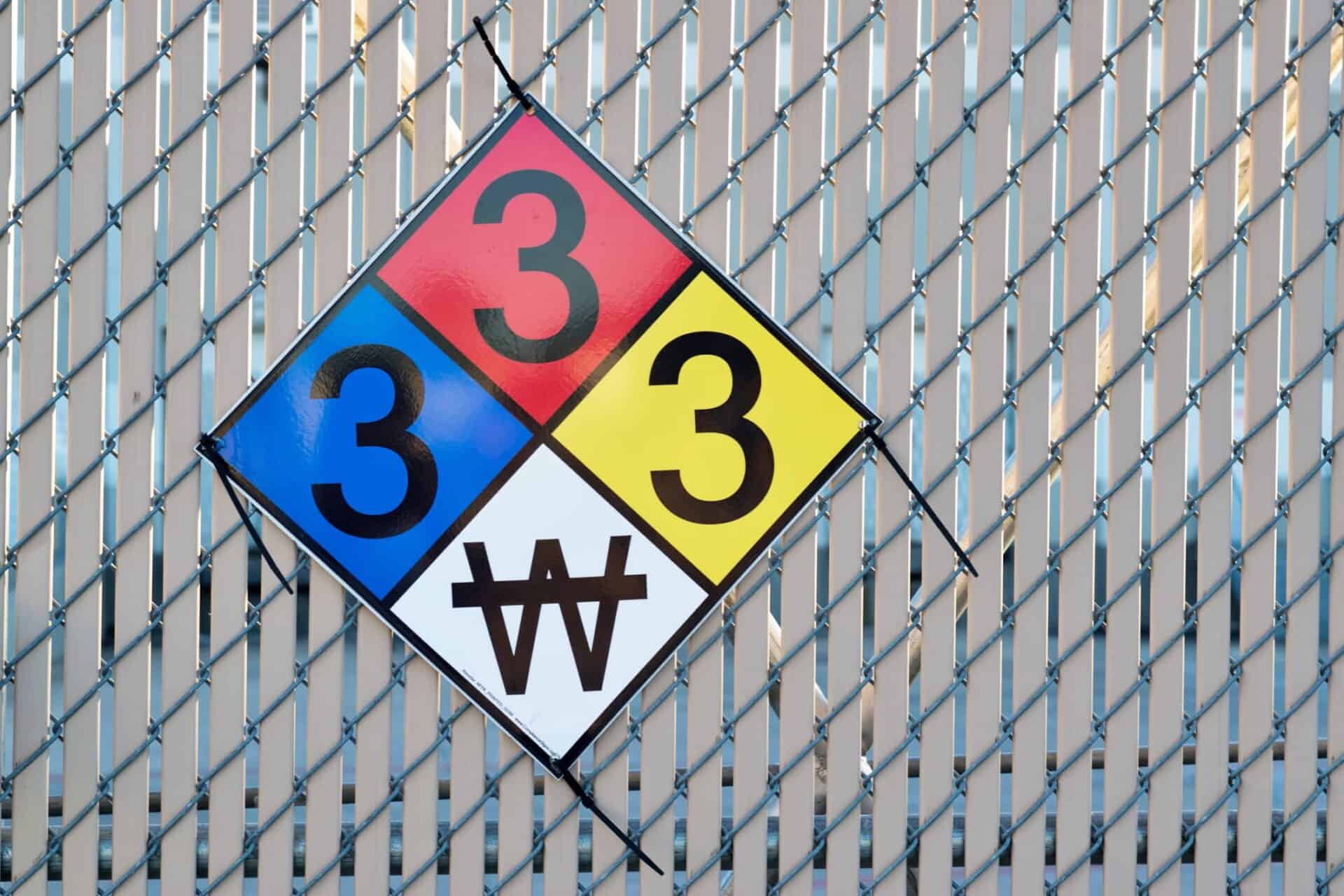
City of El Cajon Tracks Hazardous Material Placards
GIS can be used in many ways to improve the operations of cities and local governments. The City of El Cajon uses GIS to discover,...


GIS can be used in many ways to improve the operations of cities and local governments. The City of El Cajon uses GIS to discover,...

GIS people to the GIS people. Quartic excels at providing highly technical solutions to complex problems. However, fast response and general staff augmentation can be...

Geographic Information System (GIS) technology can be used in various industries to enhance efficient data usage and, through that, better decision-making. Long Beach Transit (LBT)...

Have you ever realized that the land you live in is being measured, mapped, and maintained by someone? The San Diego Geographic Information Source (SanGIS), a...

Everyone counts, address or not. Making Los Angeles a better place to live for everyone is not easy, but the Los Angeles Homeless Services Agency...

The City of San Diego has recently expanded its green waste recycling program to include weekly organic waste recycling collection for all households currently eligible...

Cupertino engaged an experienced Esri Business Partner, Quartic Solutions, to plan and deploy its ArcGIS Enterprise on AWS. The city moved from a single, internal...

GIS Tools that Help The County of San Diego recently upgraded to a full ArcGIS Enterprise environment, and since then, the number of users accessing...

Pursuing open data, transparency, and collaboration in the GIS world is a rather large undertaking technology-wise. If you don’t get ahead, the risk of falling...

GIS is a crucial unifying technology for the City of San Diego as it works to support and sustain its 1.4 million citizens. The City...